November 30, 2012

Trail Science 103: Tread Maintenance


Tread is the part of a trail that is actually walked on. Usually, and especially in the mountains, tread is constructed by cutting away varying amounts of the slope. The upslope must be cut into to form a flat area, which is the tread. Different ratios are used to measure the cut into the upslope, often depending on the soil type. A rocky upslope can have a steeper cut (backslope) into the slope because a harder material can hold together better than a loamier soil.

Other than water, two enemies of tread are slough and berms. On hillside trails, slough is soil, rock, and debris that has moved downhill, narrowing the tread. If slough is not removed from the tread, a trail will tend to "creep" downhill. Sloughing can be caused by hikers walking closer to the upslope side of the trail than the downslope or by too steep of a backslope.

Where as slough builds up on the inside of trails, berms build up on the outside. Berms will keep water from sheeting across a trail, keeping water on the trail. When the water can’t sheet, it flows down the length of the trail, carries away soil and, and as a result, builds up an even bigger berm.

Next: Stream Crossings

November 28, 2012

Trail Science 102: Keeping water off the tread


“The whole point of trail work is to get dirt where you want it and to keep it there. Water is the most powerful stuff in your world. Gravity is water's partner in crime. Their mission is to take your precious dirt to the ocean. The whole point of trail work is to keep your trail out of water's grip.” – Trail Construction and Maintenance Notebook
Trail with water
Trail with water (Photo credit: Wikipedia)

So, water is the great nemesis of trail development and preservation. Two ways to keep water off a trail are frequent grade reversals and outsloping the entire tread.

Water flows down a hill in sheets, referred to as sheet flow. To keep these sheets crossing the tread of a trail without puddling or running down the length of the trail, frequent grade reversals are needed. This simply means that a will designed trail should have its ups and downs. According to the forest service, a trail should have frequent grade reversals that extend for 10-15 feet.

An outsloped tread is one that is lower on the downhill side of the trail than it is on the inside or bankside. Outsloping lets water sheet across the trail naturally. A trail’s tread should be outsloped at least 5 percent, but not so much that it is awkward to walk on. Maintaining a trail’s outslope is key to keeping water from puddling.

Next: Tread

Enhanced by Zemanta

November 27, 2012

Trail Science 101: Trail Design


In a previous post a few days ago I said I would be writing a series of posts on “Trail Science.” This is the first installment following my introduction into what I like to call Trail Science.

According to the U.S. Forest Service’s Trail Construction and Maintenance Notebook, “There is a real art to trail layout.” It goes on to say that it takes a lot of experience to acquire an eye for proper trail building.

A particular trail’s specifications depend on several things, including what recreational activities will be performed on the trail, the amount of use and the characteristics of the trail’s particular landscape.


Typical hiking trail path in the redwood parks...
Typical hiking trail path in the redwood parks.  (Photo credit: Kid Cowboy)
The steepness of a hill or mountain gives a trail its difficulty quotient. The steeper the hillside, the more excavation will be needed to cut in a stable backslope. The trail’s grade on a steep hill also has a direct bearing on how much design, construction, and maintenance work will be needed to establish solid tread and keep it solid.

It is a general rule in trail building that a high-use trail should be built with a 5-10 degree grade. I can guarantee that no one told the builders of the trail up Mount Defiance, located on the Oregon side of the Columbia Gorge, of this rule. When 20 degrees or more, a trail becomes very difficult to maintain, let alone hike.

A trail should also be “aesthetically functional,” meaning it takes advantage of an area’s characteristics, making it appear as though it just appeared. It fits the setting.

A basic rule in trail design is the he half rule. It says that the trail grade should be no more than half the sideslope grade of the hill it is on. For example, if a hill has a 6-percent sideslope, the trail grade should be no more than 3 percent.

There are many other rules and specifications in the science (or art) of trail building. Those are more appropriate for upper level work, not the 100 series I will present to you in the coming days.

Next: Water - a trail's nemesis

Enhanced by Zemanta

Another hiker rescued in Phoenix, the U.S. leader in hiker rescues

The 65-year-old woman was carried down Echo Canyon Mountain in Phoenix Monday by paramedics after she suffered from what one of the hiker's friends described as a "panic attack," according to an azfamily.com report. The same friend of the hiker said the woman got concerned as she was walking up the mountain toward the steel guard rails used as support.
Larry Nunez with the Phoenix Fire Department said more hikers are rescued in Phoenix than anywhere else in the country. The attractive weather and trails play a major role in the large number of service calls.
So far this year there were 232 mountain rescue calls for help, including Monday's call. That number is up from 167 in 2011.
"People often don't pay attention to the trail markers or the rating system," Nunez said.

How the views have changed in Glacier National Park

Believe what you might about global warming and its causes. Here are some great historic and newer pictures of Glacier National Park.

http://www.dailymail.co.uk/sciencetech/article-2239189/The-Glacier-National-Park-soon-change-global-warming.html

November 26, 2012

Grizzly sow attacks hikers in British Columbia


November 26, 2012 - Two hikers were attacked by a grizzly bear in Southeast British Columbia on Sunday, according to CTV News.  

The man and woman had been walking in Cherry Creek, near Kimberley, B.C., when they came across a grizzly bear feeding on a deer it had killed. “The hikers got within 15 feet, unknowingly, and it startled the grizzly bear,” Sgt. Joe Caravetta, of the East Kootenay Conservation Officer Service, said Monday.

The grizzly bear attacked the female hiker first, then turned on the male hiker, only to return to the female and continue its attack. The woman is in her late 50s and the man is 80.

Sustaining bite injuries to the head, arms and legs, the pair were rushed to a local hospital and then flown to a Calgary hospital where they remain in stable condition.

After assessing the evidence, conservation officers classified the incident as defensive in nature. The bear was believed to have two cubs with it. “The bear was just defending its food,” Caravetta said, adding that had the grizzly been acting in a predatory fashion, conservation officers would be pursuing the animals to destroy them.

The man and woman are local to the area where the attack occurred, and regularly hike there.

Enhanced by Zemanta

November 24, 2012

“Trail science” is the base under which hikers experience the wilds

English: Hikers on the Steiregg hiking trail, ...
Hikers on the Steiregg hiking trail, above the town of Grindelwald, Switzerland. This is one of many spectacular and well-maintained hiking trails in the Swiss Alps. (Photo credit: Wikipedia)

Hikers who walk a myriad of trails know a good trail from a bad one. Detecting a bad trail is as simple as feeling it – in your feet, ankles, knees and hips, as leg muscles and joints adjust to poor trail conditions. Few things are worse on a hike than walking on a trail two feet wide and shaped like a half-pipe.

For the simple reason “if you’re gonna do it then do it right,” entire books and papers have been written about what I call “trail science.” It is the construction of good trails that will need minimal maintenance, maintenance that will correct a situation so it doesn’t happen again or for a decent length of time, and reconstruction of trails that were ill-conceived in the first place.

Because so many guides regarding “trail science” exist, I will use the U.S. Forest Service’s The Trail Construction and Maintenance Notebook for a series of posts in the coming days. Trail science is like any other science: it can get bogged down in the finer points a lot of people don’t much care about. The Forest Service’s manual also contains such information. It will be my job to make “trail science” interesting for hikers, something they can use to enjoy the hiking experience even more.  

Enhanced by Zemanta

November 23, 2012

Oregon wolf packs are mingling, setting up a rendezvous between OR-2 and OR-4


November 23, 2012 - Oregon Department of Fish and Wildlife researchers have discovered for the first time that wolves from two different wolf packs have bred.


Mollies Pack Wolves Baiting a Bison
Wolves Baiting a Bison (Photo credit: Wikipedia)
Sate wolf coordinator Russ Morgan said, "This is the first time we've been able to genetically show it. This is a confirmation of the necessary genetic interchange among packs, and that is a good thing."

Morgan said while the discovery of a wolf born into one pack successfully reproducing in another is not groundbreaking, it does show that packs are dynamic and change over time.

There are now six packs in eight different areas of the state, with wolves in some areas not in a big enough group to yet be considered a wolf pack.
Wenaha River
Wenaha River (Photo credit: Pig Monkey)

The discovery was made by analyzing scat from the Wenaha pack’s pups. Each time a wolf is caught and collared by the state agency, a genetic sample is taken, Morgan said. The department confirmed with a genetic sample that OR-12 is the progeny of OR-2 of the Wenaha pack and OR-4 of the Imnaha pack.


Enhanced by Zemanta

November 21, 2012

Lightning strike evidence of Mother Nature's power


A recent lightning strike and its deadly outcome at a NASCAR race in Pennsylvania reminded me of the time I witnessed the remnants of a lightning strike near Timothy Lake in the Oregon Cascades. It was yet another reminder of how awesomely powerful Mother Nature can be.


Rajneesh recollections: Visits to Rajneeshpuram and a strange encounter


Osho Rajneesh Drive-by in Rajneeshpuram
The other night I was watching a show on the Rajneeshees, a group of folks that infiltrated northern Central Oregon in search of communal living and oneness with their spiritual leader, Bhagwan Shree Rajneesh, later known more simply as Osho. Anyone living in Oregon at the time, in the early 1980s, remembers him and his band of followers who wore various shades of red and a necklace bearing Bhagwan's picture.


Black Wolf Meadows elicit old story and trigger imagination

English: A wolf nurses her pups outside their den.
 A wolf nurses her pups outside their den

Wolves are making a lot of news lately. From wolf hunting in the upper Midwest to the expansion of the habitat, including into Oregon, wolves are a hot topic.. The latest news of wolves jarred loose the memory of a hike taken several years back into the area of High Rock atop the Clackamas River drainage.

November 20, 2012

Oregon's explosive past seen along the PCT south of McKenzie Pass

From left: Belknap Crater, Mt. Washington, Three Finger Jack and Mt. Jefferson

If a person wants to see evidence of recent volcanic activity, and by “recent” I mean within the past few thousand years, there is no place better than the Central Oregon Cascades. In this area, perhaps the best place to view this activity is along the McKenzie Pass. Here, a string of craters that once spewed immense flows of lava and spit cinder high into the air stretches for miles.

November 19, 2012

Landfill at Fish Lake shocks, angers

Calvin "The Wonder Dog" at Lower Lake

From the edge of the Olallie Lake Scenic Area, hikers can begin near the end of road 120 on a trail leading to a string of lakes within the scenic area. Unfortunately, negative human elements and nature can clash, which was the case when I hiked the path, known as the Fish Lake Trail. This hike is only 2.8 miles long, but filled with great scenery, especially if you enjoy lakeside views of the surroundings.

November 18, 2012

A few things to know about rattlesnakes that the Lone Ranger and Tonto didn’t


Modified tail scales form a rattle on a Wester...
Modified tail scales form a rattle on a Western Diamondback Rattlesnake Crotalus atrox. (Photo credit: Wikipedia)

In a post from a few days ago, I wrote about a trip a friend and I took to eastern Oregon near the Idaho border in search of rattlesnakes. We were told the location of a rattlesnake den in which we caught several of the snakes. Over the years, I’ve had several encounters with rattlesnakes while either hiking or camping in Oregon, but really knew little about them. Even after keeping a live rattlesnake in an aquarium for a few years in my living room, feeding it mice on occasion, I still knew little about them. So I did some research on rattlesnakes, which might help folks understand them a little better.

November 17, 2012

Rattlesnake den provides a day of adventure

An old drawing of rattlesnake

It wasn't much of a hike, walking across a small portion of eastern Oregon, looking for "a large boulder" at which point we were told to "take a right." We had no idea whose property we were on, and knowing we were trespassing, watched carefully for anyone who might have a rifle aimed at us.

November 15, 2012

Cutting Christmas trees a good excuse to head to the mountains


Firs
Firs (Photo credit: mickydelfavero)
We don't have a lot of family traditions, so when we head to the mountains around Thanksgiving to pluck a couple of Christmas trees from the Cascade Mountains' wooded wilds, we try to make it a little bit of an adventure. Usually, the search consists of driving roads near 3,000 feet in elevation or below, depending on snow levels, trying to find something close to the perfect tree.Typically,after looking for several hours, it begins to get dark and we're then forced to quickly chose trees resembling the 50 or so we had looked over the three hours before.

Part of the problem is that we don't need just one tree, or two, but three. If it were up to me, I'd find something with a few branches, throw it in a stand and call it good. One of the best Christmas trees I ever had was when I was in my early 20s and living with a buddy. We found a tree in the woods, made decorations out of beer cans and used a bat I had caught and froze as the tree topper. Of course, that bat wouldn't have been much of a tree top ornament had we not used some wire to spread spread its wings as if it were flying. It was a sight to behold!

The first thing you need to do is get a permit for each tree you plan on cutting down. They are $5 each and can be found at a limited number of stores and national forest ranger stations. The limit is five permits per household.

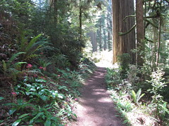
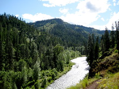
Over the years we've learned some tips on finding a decent tree in the woods. For instance, the higher in elevation you can get in the mountains, the better chance there is of finding a decent tree. There is, of course, an elevation where trees do get scrubby, but just below that elevation one can find some shapely fir, spruce or cedar. Because the best trees are found at higher elevations, we often find ourselves trudging through snow to locate the trees.

Because trees in the woods aren't groomed by way of shearing, they won't be as full as those found on Christmas tree lots. Their branches won't usually be as strong as those found on a lot, either. So, when you find one in the woods you like, make sure the branches and tree tip will hold all the decorations you plan on loading it with, so it doesn't sag like a wet noodle.

We tend to like Noble firs. They don't have a a lot of branches, but the branches they do have tend to grow uniformly, straight out from the trunk every foot or so. This leaves some gaps between branches that work well for dangling ornaments or those ornate strings of beads that can droop.

A fuller tree that has a good shape is the Grand fir. Although the branches on these are more prolific, they are usually weaker, so if you have heavy ornaments that hang from branches, this may not be the tree for you.

Some spruce trees can be found out in the woods, but they can be a bit prickly. Douglas firs are also available, but when cut from a forest, they seem the least suited for a Christmas tree.

One of the great advantages of the Noble and Grand firs are their smell. Freshly cut from the forest, they put out a great fragrance when placed in your house.

We usually cut our tree on the east side of Mt. Hood. Some of the rules within the Hood River and Barlow Ranger districts, which are located on the east side, include:

*Only trees 12' in height or less many be cut. A permit for taller trees may be obtained at an additional cost.
*Cutting the tops of trees is prohibited. Stumps must be less than six inches off the ground and all branches must be removed from the stump.
*Another tree, free to grow, must be within 8' of the tree you cut.
*Trees may not be cut in wilderness areas, within 100' of a trail, 200' of campgrounds, recreation sites or within 300' of a stream or lake.

Make sure you are cutting your trees in an area that allows it. Except for a few designated areas, the Hood River and Barlow Ranger districts are open.

A list of these and a few other requirements are issued when you purchase your permits.

Most importantly! Make sure you take necessary precautions and supplies, like appropriate clothing, food and water. You are in the mountains during a time when weather can be volatile. Take a map if you are unfamiliar with the area. Do not trust your GPS for finding forest service roads. These same roads are not plowed and can accumulate several inches of snow in a short period. For this reason, it is wise to carry chains, a shovel and a flashlight.

Enhanced by Zemanta

November 14, 2012

Hitchhiker reminds of dangers lurking


Timothy Lake log bridge
Timothy Lake log bridge (Photo credit: freddy)
As the father of a teenage daughter and because of the number of  girls perpetually reported missing and eventually found lifeless, I feel the need to tell girls and young women to stop getting into situations that make them an easy target. It is sad things have come to this, but it is a fact of life.

Unfortunately, society has taken a long and drawn out turn for the worse. As for the reasons behind this decay, that is a subject for another time. For today, a growing number of predators now walk within the urban jungle. Unfortunately, they most often find their prey before they can be hunted and thinned from the herd.

What prompts me to say this is the memory of finding a girl years ago in the mountains, up around Timothy Lake - all by herself. After hiking around the lake one fall day, after the summer crowds had left, I saw a hitchhiker along the main road near the lake. Soon, I noticed it was a girl. I was on my way home and had barely driven a mile down the lonely road when she appeared.

November 12, 2012

It just goes to show – you never know who you will meet on the trail


November 12, 2012 - Brandon Musto, 37, who escaped this past Wednesday from Monroe prison's minimum security ward in Washington was found and arrested Sunday night in a wooded area near North Bend by a King County Sheriff's Office SWAT team and a police dog, according to the Sky Valley Chronicle.

A hiker on Rattlesnake Ridge Sunday afternoon encountered a man who looked out of place and asked the hiker to borrow his cell phone to call his mother.The hiker with the cell phone felt something about the encounter didn’t quite seem right so when he got home he did some online research and came to the conclusion he had spoken with the escaped prison inmate Musto.

The man who used the cell phone had left behind his mother’s phone number. The sheriff’s office verified that the number belonged to Musto’s mother and then sent out the SWAT team and the police dog to search. The escaped inmate at first tried to run and hide, according to authorities but he was eventually caught by the police dog.

Musto had only a few months left to serve on his sentence before he escaped. Now he may be facing a new charge and more prison time. He began serving his prison sentence in September 2011 after he was convicted of vehicular assault.

Experiencing nature naked prompts lewdness conviction


A 62 year-old man pleaded guilty last week to two counts of open lewdness after he was caught in July hiking nude, except for tennis shoes, on Blue Mountain in Pennsylvania, according to Pocono Record.

"It's the only way to hike the trail," the naked man, Harry Rohrman, told Trevor Jones when they encountered each other on the trail in August 2010 near the Lehigh Gap.

Rohrman was charged this year after that same man, Trevor Jones, encountered him again on Blue Mountain — and again nude.

Rohrman told police he used to live in a nudist community in North Carolina before his wife of 20 years left him. He then moved to Pennsylvania to live with his son.

Rohrman said he couldn't afford the fees for Sunny Rest, a nudist resort in Carbon County, and so had begun walking access trails to the Appalachian Trail and trying to avoid people, police said.

"I suggested he no longer walk the trail naked," Lehigh Township patrolman Robert Gogel Jr. wrote in the arrest report.
Enhanced by Zemanta

November 11, 2012

Sasquatch sighting downtown astonishes


I saw Bigfoot the other day. Yes, it was during the day. Why would a Sasquatch be out during the day for me to see? I can’t tell you why. I assumed they were primarily nocturnal. Maybe this one got night and day confused. Furthermore, the sighting occurred downtown, where you would never expect to see Bigfoot. It made me wonder whether humans are encroaching on Bigfoot habitat or Bigfoot is encroaching on humans. After all, so many folks claim to have seen ‘Squatch and their footprints that one can only assume that several ‘Squatch roam the woods.

November 9, 2012

Ornery owls protect their territory by attacking unsuspecting hikers

A Barred Owl on show at Arizona Renaissance Fe...
A Barred Owl on show at Arizona Renaissance Festival, Apache Junction, Arizona, USA. (Photo credit: Wikipedia)

A section of trail in Soaring Eagle Park near Sammamish, Wash., remains closed after a number of reports of attacks by an aggressive owl, according a KING5 report. Another woman was attacked in Bridle Trails State Park near Kirkland, Wash., last weekend.

The birds are believed to be barred owls, which can be aggressive in defending their territory. Warning signs were posted a few years ago at Saint Edward State Park near Kirkland after similar incidents.
"It felt like a sharp tearing, stinging, feeling in the back," said Celina Calado. "He grabbed both sides of my pony tail with his claw." The owl then flew away to a tree. Calado was bleeding from scratches to her head and went to the emergency room.

With at least six attacks, parts of Soaring Eagle Park in Sammamish are now closed to the public, according to the report.
Barred Owl
The Washington Department of Fish and Wildlife believes the owls responsible are young ones and are territorial about their new nesting spot.
According to the Cornell Lab of Ornithology, Barred Owls are large, stocky owls with rounded heads, no ear tufts, and medium length, rounded tails. Their feathers are mottled brown and white overall. The underparts are mostly marked with vertical brown bars on a white background, while the upper breast is crossed with horizontal brown bars. The wings and tail are barred brown and white. Their eyes are dark brown, almost black.

Barred Owls roost quietly in forest trees during the day, though they can be heard calling in daylight hours. At night they hunt small animals, especially rodents, and give an instantly recognizable “Who cooks for you?” call.

Barred Owls live in large, mature forests made up of both deciduous trees and evergreens, often near water. They nest in tree cavities. In the Northwest, Barred Owls have moved into old-growth coniferous forest, where they compete with the threatened Spotted Owl. More aggressive than Spotted Owls, Barred Owls are suspected to be driving Spotted Owls from the old growth habitat.

Enhanced by Zemanta

November 7, 2012

YouTube video shows what some believe to be Bigfoot


Okay. After years of hearing about Sasquatch, aka Bigfoot, I have to weigh in on whether this beast exists or not. Let's get this out in the open right now. I don't believe 'Squatch exists. I just don't.

I bring this up because 'Squatch has once again made an appearance in the imagination of millions via a supposed sighting and videotaping in the Utah outback.

A buddy system while hiking may help keep you alive, but so might simply staying at home


When anyone slips that pack on their back and enters a wilderness area, they are taking a certain amount of risk. Terrain, weather, critters and the possibility of going off in the wrong direction can all present issues that could inevitably result in death. On the other hand, slipping a seat belt over your shoulder and driving onto a freeway can also have a bad outcome.

November 6, 2012

If you've ever seen a grizzly bear attack prey, you realize they are killing machines, equipped with tearing teeth and slashing claws. What about when they get trapped in a car for a while. I was sent these pictures the other day of the inside of a Toyota Sequoia. The first picture is that of a Sequoia without griz damage. The rest of the pictures were taken after a griz somehow got stuck inside a fully optional, $70,000 Sequoia.

Recorded Oregon bear attacks now at five after hunter is roughed up

English: Black bear in the Canadian Rockies
English: Black bear in the Canadian Rockies (Photo credit: Wikipedia)
A few days ago I wrote about bear attacks in Oregon and, more specifically, how rare bear attacks are in the state. Only four recorded bear attacks have occurred in Oregon. Two of those four attacks were when hunters thought the bear they had shot was dead, only to discover it was not. Now, a fifth recorded incident in Oregon has occurred, again, involving a black bear and its hunter.
The hunter was injured when the bear he thought he had killed jumped up to attack the hunter. Alex Machado was about 10 feet away from the bear he thought was dead from a gunshot when it rose and came running at him, swiping and biting.

"(The) thing popped up and just came right at me," the 22-year-old recalled from his Medford home, where he is recovering. Machado ducked behind a tree, swiping at the bear with his hunting knives. His friend and hunting partner, Nathan Shinn, 24, fired a warning shot, which had no effect.

Range map of the American Black Bear (Ursus Am...
Range map of the American Black Bear (Ursus Americanus) updated, see: http://blogs.courierpostonline.com/fishhead/files/2008/12/beardist.jpg http://www.nps.gov/shen/naturescience/images/va_dgif_bear_map_556.jpg http://www.dec.ny.gov/images/wildlife_images/bearngexp9507.jpg http://www.ncwildlife.org/Wildlife_Species_Con/images/bear_dist_map.pdf (Photo credit: Wikipedia)
The bear then knocked the knives aside and bit down on Machado's arm, then his hand. He yanked his hand back and started to slip down a nearby slope. The bear bit him again on the inside of his upper leg. Both tumbled down the slope together.

Machado reached the bottom first, landing on his back. The bear hit next, its back against Machado's chest. Machado wrapped his arms around the bear's throat and squeezed as tightly as he could, screaming for Shinn to take the killshot.

Shinn shot the bear and Machado heard its final breath. He crawled out from underneath the animal and laid down about 10 feet away, trying to calm the tide of adrenaline. Shinn started making calls to 911.

Machado started walking back uphill, hoping to meet rescue workers when they came. He estimates walking about a mile and a half before getting picked up. Shinn stayed behind, trying to stay in touch with emergency services because of the spotty cell phone service.

The Jackson County Sheriff's Department tracked him to an area near Elk Creek Road and picked him up for transport to Asante Rogue Regional Medical Center for treatment. Machado's wounds required hospitalization, including several stitches.
Enhanced by Zemanta

November 3, 2012

Research in Jefferson Park - another study to tell us what we already know?

Jefferson Park and Mt. Jefferson

Sometimes you have to wonder about scientific studies and the resources spent to research things that seem to be obvious. You also have to wonder how some conclusions are ascertained. Here is one of those instances.

According to a study by Oregon State University, funded by the Pacific Northwest Research Station and published in Landscape Ecology, high mountain meadows in the Pacific Northwest are declining rapidly due to climate change. An article written by Phys.org says the study cites factors such as reduced snowpack and longer growing seasons as reasons for trees to encroach on meadows.
Scout Lake in Jefferson Park


November 2, 2012

Search to find missing hiker in Sierras called off

Paradise Valley in Kings Canyon National Park
Paradise Valley in Kings Canyon National Park (Photo credit: Wikipedia)
November 2, 2012 - Efforts to locate missing hiker Larry Conn in the eastern Sierra Mountains were suspended Thursday after an intense search revealed no clues, according to the Pacific Palisades Patch.
The search for Conn, 53, lasted eight days, utilizing 56 personnel from multiple agencies, with 10 ground search teams, three dog teams, and five helicopters.
Conn was last seen by an outbound hiker when entering the rugged wilderness of Kings Canyon National Park Oct. 19. A snow storm dropped up to 12 inches of snow the night of Oct. 20. Conn was reported overdue to the Inyo County Sheriff’s Department on the evening of Oct. 23, and the Sheriff’s Department confirmed his vehicle was still at the trailhead. On Oct. 24, the Inyo County Sheriff’s Department notified the National Park Service of the missing hiker. Search operations began in Kings Canyon National Park on Oct. 24.
The search area covered a total of 48 square miles of terrain ranging in elevation from 8,000 to 14,000 feet. Nighttime temperatures dropped into the teens. Snowdrifts made the search by foot difficult and two searchers were evacuated by helicopter due to medical concerns related to the severe conditions.
Enhanced by Zemanta