July 17, 2013

“Old” Vista Ridge trail provides good views of northern Cascades, thanks to its restoration


Mt. Hood from Owl Point
I didn’t know an “old” Vista Ridge trail along the north side of Mt. Hood even existed until only a few weeks ago. Having hiked the popular Vista Ridge trail years ago, I decided to take the lower, lesser-known trail to its end, where the remnants of an old fire lookout linger. Once on the trail, I discovered I left my camera at home, so had to fall back on my cell phone for pics. My apologies. Not that these are much worse than those I take with my camera.

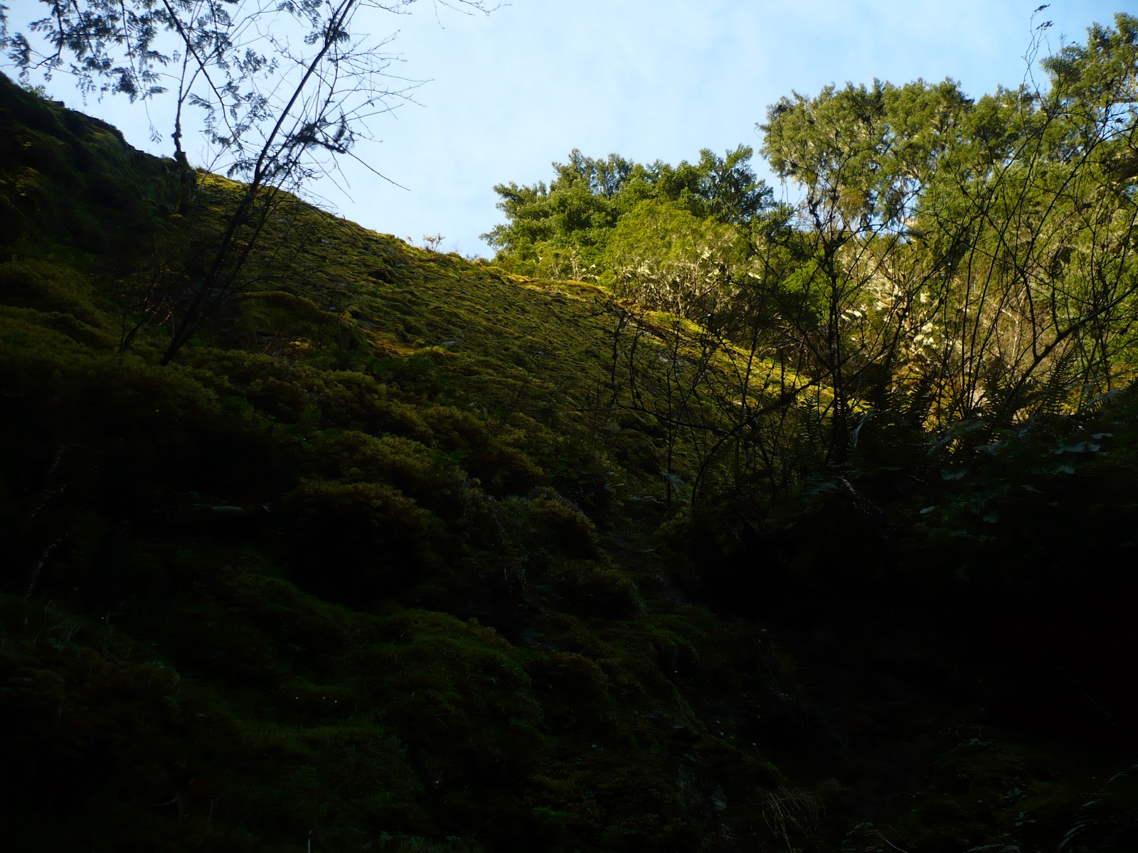
Burned trees from the Dollar Lake Fire near the trails' junction
A short access trail, about 0.3 of a mile long, leads to a three-way junction where the path to the left is the “old” Vista Ridge trail, which connects with the trail leading to Cairn Basin and Barrett Spur to the right. Here, remnants of the 2011 Dollar Lake Fire exist. It appears this is about as far north as the fire spread, leaving the old trail free of ravaged forest.

Heather in the meadow leading to the Rockpile
The old trail is easily hiked because of a group of “pathologists” who helped restore the health of the old path. They need to be commended, because without them removing debris from the path, which apparently included over 200 fallen trees, the trail might have died.

Owl Point View - Brownish grey on lower slopes is from the Dollar Lake Fire
As it is, the trail is padded with forest debris, such as evergreen needles, beneath the thicker, second-growth forest canopy. Where the trail opens up along the ridgeline, it becomes boulder strewn and rugged. The most rugged portion of the trail begins as it makes its way from Owl Point down to where a fire lookout once stood and nearby Perry Lake.

View East from Owl Point. Laurence Lake to the right appearing behind ridge

Owl Point provides a nice view of nearby Mt. Hood. There, I discovered a small ammunition box with an entry journal inside. The story of the trail’s restoration resides within this book’s cover.

One of two foundations at the old lookout site
From Owl Point’s view, the immensity of the Dollar Lake fire and its impact on the area is apparent along the slopes of Mt. Hood. To the east, a portion of Laurance Lake is within view.
Road leading from lookout site to Perry Lake
 
From here, the trail drops toward Perry Lake. Just prior to the lake, the trail ends at a road that once provided transportation to the fire lookout. I found two cement foundations at the site - which one was the lookout is a good question. Perry Lake (actually a small pond) is a short distance downhill from the foundations along the rocky road.
Perry Lake
 
Just beyond Owl Point, on the return trip, I stopped at another viewpoint, this time looking north toward Mt. St. Helens, Mt. Rainier and Mt. Adams. In front of them stands Mt. Defiance on the Oregon side.
Left to right: Mt. St. Helens, Mt. Rainier and Mt. Adams

 
I did not meet another person on the trail that day until I got back to the junction with the more popular part of the Vista Ridge Trail. To my surprise, the parking lot that had one other car in it when I pulled in that morning was now packed. That meant all those people were hiking the more popular trail. So, if you want more solitude, hike the old trail.

July 8, 2013

From Round Lake to Square Lake – Views between the silver poles


Three Fingered Jack standing above Round Lake
From the Northwest corner of the Mt. Jefferson Wilderness, where I had hiked into Crown Lake, I headed toward its Southeast section, where forest fires have dramatically changed the landscape. Clearly, new vegetation has established itself among the silver poles, which were once thriving conifers, standing above the fresh greenery.

Round lake through the silver poles

I expected a full campground at Round Lake when I arrived there in the evening. However, no one else was there, except for some fishermen parked near the lake. This was surprising, considering it was the beginning of July, the weather was spectacular and there is only about three (I didn’t count) campsites at Round Lake.


Sun setting over Round Lake
Having planned to hike into Square Lake the next morning, I set up camp and watched the sun drop behind the West side of the high Cascades. The lake has a great view of Three Fingered Jack, which I’m not sure would be as brilliant if the forest was fully foliated, as it was prior to the fires.


Trailhead sign to Square Lake
Knowing it would be hot and shade would be scarce, I hit the trail early the next day. The trail climbs from the West end of Round Lake up over a ridge before flattening out. Here is where, with a little imagination, one can see that views are much more expansive without the foliage from pine trees blocking one’s sight. Although the silver poles left standing are somewhat unsightly, they allow views of the area that one might never have seen had it not been for the devastation. “Unsightly” might even be too strong. “Unusual,” perhaps, is more appropriate.


Square Lake
Although it was only about 8:00 am when I arrived at Square Lake - about 2 miles from the trailhead - the bare forest had warmed quickly. Continuing to the West end of the lake, I chose to go left at a trail junction, which took me South toward the Santiam Pass. After a short and gradual uphill hike, I stopped at a small saddle, where views of Mt. Washington and the Three Sisters appeared. From there, a short scramble to the top of a rock outcropping provided a grand view of Square Lake below and Three Fingered Jack to the North.
 
Mt. Washington and Three Sisters through the silver poles
My map showed a “Long Lake” near the trail between Round Lake and Square Lake, but I didn’t see it on the hike into Square Lake. So, on my way back, I made it a point to look closely for Long Lake or any side trails that might lead to it. None were found and no lake was seen.


Three Fingered Jack from rock outcropping above Square Lake
One thing I did notice, though, was the number of trees growing to replace those that had burned. The numbers of these small pines in some areas are prolific, roughly four feet tall and seemingly growing like weeds. In other areas, there are none.

Black Butte from road 1210
On my way back down out of the mountains from Round Lake, I continued along road 1210 along its southern-most stretch. This section of road provides outstanding views of the Cascades stretching from Three Finger Jack to the Three Sisters.
Three Fingered Jack from road 1210

July 7, 2013

A short yet scenic hike into Firecamp Lakes


All but the top of Mt. Jefferson along the trail to Crown Lake
It was time to go back to the Mt. Jefferson Wilderness, having not entered the area since either the B&B fire of 2003 or the Puzzle fire in 2006. Both fires combined to burn 47,000 of the 105,000 acres that make up the wilderness area.

Blooming Beargrass along the trail
Entering the wilderness from the Northwest, where the Firecamp Lakes lie, there is no indication of the fires that devastated much of the wilderness. Instead, healthy conifers and blooming bear grass greeted me in late June on my way into the lakes.

Crown Lake
Firecamp Lakes are made up of Crown and Claggett Lakes and an unknown, much smaller pond.

Mt. Jefferson rises above Crown Lake
The hike to Crown Lake begins in an old clearcut, where thick Beargrass was in full bloom. The trail climbs steeply from the outset through much of the clearcut and then settles into a much easier grade as it enters the more established forest.

Crown Lake
Crown Lake lies only about a mile from the trailhead. The trail, prior to dropping into the lake’s basin, provides nice views of Mt. Jefferson above the ridge standing over the lake’s basin. Plenty of mosquitoes were there to greet me at the lake, expected but always unwelcome.   


May 27, 2013

Opal Creek old growth hike a reminder of past, changing times


Opal Creek

It was the epicenter of the spotted owl debate in the early 1980’s, drawing attention from around the country, as the timber industry, so entrenched in the lives of those inhabiting the Pacific Northwest, battled conservationists for the future of forestlands surrounding Opal Creek.
Old Growth Forest along the Little North Fork Santiam River

It was a gorgeous yet somewhat breezy weekend in late April when I drove to the gate across the road (2209) accessing Opal Creek and Jawbone Flats. My intention was to backpack into the area and set up a camp somewhere near Opal Pool, where rushing waters flow through a small gorge and drop into slower moving, deeper  and aptly named waters.
Road leading to Jawbone Flats

The gravel road soon crossed a bridge over picturesque Gold Creek. From there, large trees appeared in greater numbers, until the towering behemoths and regenerating undergrowth indicated I was standing in an ancient forest.

Gold Creek from bridge
Looking out into the forest from the road, immense tree trunks stood high above forests lush understory. It all looked so alive. However, a lift of the chin and look to the sky gives hikers an entirely different perspective. Many of those massive tree trunks are topped with few branches, if any. Many are nothing more than a snag. In fact, many of the largest trees in any old growth forest are dead.

Dead old growth waiting to fall
After about one mile, the road, carved out of an extremely steep slope, is so narrow that bridge-like beams support its outer edge, making the road wide enough for vehicle travel. The road is used by folks living in Jawbone Flats needing to access the outside world by vehicle.

Narrow road widened by beams and planks
After two miles, machinery and parts left behind from the old Merten Sawmill begin to appear. Built in 1943, the steam powered mill utilized timber in the immediate area until it closed not long after opening. Apparently, the company’s log trucks were falling off the narrow and steep section of the road, making it too dangerous to log the area. One building at the site still stands.

Machinery left from Merten Sawmill
Behind the mill from the road, the Little North Santiam River flows over a basalt ledge to form Sawmill Falls. A short side trail delivers explorers to a view of the tumbling waters.

Sawmill Falls
Why I had yet to venture into the Opal Creek area, dismissing it throughout the many years of hiking through the Cascades, was no mystery. For me, the battle for these forests had left a foul impression. It was my opinion that folks were robbed of their livelihood by a movement that enlisted folks who cared more about trees and owls than people. On the other hand, I had witnessed how clear-cutting a forest could virtually destroy it. I understood why those folks would want to conserve a place like this. In a way, the old remains of the sawmill represents what the area was, could have been and is today.

Clear waters above Sawmill Falls
A short distance after the old sawmill site a trail to the right takes hikers to a bridge crossing of the Little North Santiam River. From there, the trail parallels the south side of the river for roughly another 1.5 miles to Opal Pool.

Bridge leading from road to trail
Along this trail are several spots to set up a tent and spend the night. After crossing Opal Creek over a bridge at Opal Pool to the east of Jawbone Flats, I backtracked west through a meadow and sat down inside a small shelter. After eating some lunch, I headed back to the trail, found a camp spot and set up my tent.

Along the trail
t is here where I want to talk about choosing a spot to set up camp. I assume most backpackers know not to establish their camp too close to a body of water or trail. What folks might not realize is to also look at their immediate surroundings when putting up a tent.

Bridge above Opal Creek gorge
On this trip, I debated on two spots as possibilities to establish my tent site. With all the trees in the area and the windy conditions, I searched for those trees appearing most likely to blow over in the wind, which are usually the dead ones. The spot I was convinced had the most stable trees surrounding it was the one I chose to set up my tent. It wasn’t five minutes later when a gust of wind blew over a tree that landed no more than 10 feet from my tent. Had it landed on my tent and I had been in it, the tree would have injured me seriously, if not killed me. The morals of this anecdote are, don’t set up a tent within reach of a tree that could fall on you, and, even when you think you haven’t, anything can happen.

Opal Pool
Then it was time to explore. Again, I hiked back over the bridge near Opal Creek and made my way through the meadow and into the heart of Jawbone Flats. But, before reaching the small community from the East, I stopped to look at the old mining equipment along the side of the road, left over from the days when miners frequented these mountains.

Meadow at Jawbone Flats
Jawbone Flats consists of several buildings, some cabins available for the public, a store, educational buildings and homes for residents. One even houses a turbine used to power the community.

Jawbone Flats
Back across the bridge and onto the trail, I hiked south along Opal Creek. Unfortunately, a bridge once crossing the creek only a short distance from Opal Pool was gone. With the creek flowing too high to wade through and continue down this trail, I turned around and made my way back to camp.

Old mining tools and machinery at Jawbone Flats
I save the term “spectacular” for few areas, and this is not one of them. It is, however, a beautiful area and well worth the visit. I was both glad I finally waIked into it and disappointed it took me all those years to get there.
Camp was set up at the confluence of Battle Axe Creek and Opal Creek


Enhanced by Zemanta

February 22, 2013

Where politics meets the outdoors and why today’s journalism is a joke


U.S. President Theodore Roosevelt (left) and n...
U.S. President Theodore Roosevelt (left) and nature preservationist John Muir, on Glacier Point in Yosemite National Park. In the background: Upper and lower Yosemite Falls.
Do a Google search and see how many articles you can find on how approaching spending cuts by the federal government will affect our National Parks. I’ve been watching an endless stream of these articles come across my computer over the past couple of week. It seems like every journalist in the U.S. is writing an article on this subject.
Here’s a sample of one:

The towering giant sequoias at Yosemite National Park would go unprotected from visitors who might trample their shallow roots.

In the same article:

“Gettysburg would decrease by one-fifth the numbers of school children who learn about the historic Pennsylvania battle that was a turning point in the Civil War.”

GIVE ME A FRIGGIN’ BREAK!!!!!!!!!!!!!!!!!!!!!!!!

Trampling a giant sequoia’s shallow roots will harm a tree that has been living for close to a century?

Kids won’t learn about Gettysburg if they can’t visit it?

Apparently, Park Service Director John Jarvis last month asked National Park superintendents to show by Feb. 11 how they would absorb the 5 percent funding cuts, according to a recent report.

The report goes on to state: “While not all 398 parks had submitted plans by the time the memo was written, a pattern of deep slashes that could harm resources and provide fewer protections for visitors has emerged.”

Think for a minute about the hyperbole used by the journalist in this statement. A five percent cut is a “deep slash.” To anyone who considers five percent to be a “deep slash,” prepare to feel some real pain in the coming years!

I know of no one who wants see any cuts to the budgets of National Parks. They are truly gems. Unfortunately, politicians have run our country into such debt that the hurt is only beginning. We have started to see it in increased taxes to pay for their follies. More are yet to come. Next we will see it in cuts to government agencies. In the future, cuts to so called “entitlements,” such as social security will occur.

In a memo from the National Park Service, "Clear patterns are starting to emerge. In general, parks have very limited financial flexibility to respond to a 5 percent cut in operations."

I’ll bet that if someone was brought in from the private sector to analyze the agency they could cut 5% without any visitor evening knowing there were cuts!

Ahh, but my declaration is refuted by John Garder, a member of the nonprofit parks advocacy group the National Park Conservation Association. "In the scope of a year of federal spending, these cuts would be permanently damaging and save 15 minutes of spending, he said. “There's no fat left to trim in the Park Service budget," he added.

Then why the heck did the federal government just create a new National Park in California that will have to be paid for by taxpayers. Does that make sense!!!!

I have gotten off topic. The main reason I wrote this post is to display how rabid the reporting has been on this subject. Oh my. We’re going to have to cut 5% from National Parks. Why don’t a few of these reporters write something about the lies that constantly permeate our government or the moral decay of this country. Why don’t they write something about joblessness in the U.S. or how our government continues to lie to us about the murder of our diplomat and three other men in Benghazi, Libya.

Why not? Because instead of doing their job – making sure the government has someone looking over its shoulder, they have become nothing more than a megaphone for those in power. Congratulations journalists. You have officially jumped the shark.

Enhanced by Zemanta

February 3, 2013

Old growth forest, numerous waterfalls greet hikers along the Clackamas River Trail


Deeply furrowed, old growth fir along the Clackamas River Trail

The promise of blue skies and warmer temperatures prompted another trip into the old Cascades. As I discovered, the break in the rain had the same influence on a lot of other people. Cars and pickups, carrying kayaks and sometimes pulling trailers full of snowmobiles and quads, made their way up the Clackamas River drainage.

Stream crossing near trailhead at Indian Henry Campground
While driving along the river several miles above Estacada, I was reminded of my teenage years, when I had purchased a rubber raft and spent summer days floating the upper stretches of the river with my father or other family members. There were days back then, even in the summer, when my raft would be the only boat on that stretch of river. Since then, the river’s popularity has grown immensely among rafters and kayakers.
Rock overhang along the trail
This day’s destination was the Clackamas River Trail. Having hiked the downstream half of the trail several years earlier, I figured it was time to hike the upper half. I parked at a parking lot for the trail, located across from the entrance to Indian Henry Campground, and started up the trail.
Pair of falls along trail
At the trailhead, two trails are apparent. The trail to the left, which heads uphill immediately, is NOT the Clackamas River Trail. I don’t know where it leads. The trail to the right, the more level trail, is the correct route.
One of the trail's numerous waterfalls
Immediately, the characteristics of a low level trail in the Cascades become apparent. Moss covers nearly everything on the forest floor like a green shag carpet. Ferns grow profusely. Firs at various stages of growth make up much of the forest. In this case, however, along this trail, the trees are a bit bigger than the usual low elevation Cascade trail. Immense, deeply furrowed, old growth trees stand high above these slopes.
Moss covered rock wall above the Clackamas River Trail
The trail gradually rises a few hundred feet above the Clackamas River and remains there for much of the hike into The Narrows, a short stretch where the river runs narrowly between bulbous, fused rock.
Spring along the trail
In a mile or so, the trail skirts what I found to be the most interesting portion of the trail, the lower portion of a rock wall stretching several hundred yards. Not carrying my tape measure with me, I can’t be sure, but the height of this wall likely varies from 60 to over 100 feet high. Along this wall were, at the beginning of February, several waterfalls of varying sizes. I say “were” because some of them had so little water I doubt they could possibly exist in August.
Another of the many waterfalls
Interestingly, the falls that attracted most of my attention were those with the least amount of water. A few of these looked as if someone had taken a 20 foot length of PVC pipe, drilled a hole in it every four or six inches and ran water through it high up on the rock wall’s rim. These streams of water, separated by only a few inches, ran down the wall, dropping through and into thick moss, where they eventually came to rest at the base of the trail.
Small streams drop down the moss-covered rock wall
Along another short stretch, the trail dips into the wall’s face, carrying hikers behind one of the falls carrying the most volume of water. It is similar to hiking behind South Falls in the Silver Creek Falls area, but on a smaller scale.

From behind a waterfall, looking down at the Clackamas River
Eventually the rock wall gives way to steep, fern laden slope. Always within view is one or more of the huge trees likely at least 500 years old.
Trail in cliff wall behind waterfall
As the trail drops close to river level, it meanders along a power line clearing for a couple of short stretches before dipping back into old growth forest. Soon, old growth western red cedar trees become more prevalent. Within a grove of these huge cedars, a short side trail leads to the Clackamas River and The Narrows.
Clackamas River runs below the trail
The morning sun blanketed the grassy flat atop the rocks containing the Clackamas River at The Narrows. The river, running high, flowed through the tight channel with immense power. From the brute force of these waters to the rivulet crossings along the trail to the tiny cascades dropping from the cliffs above, this trail has a wide range of experiences for hikers.

The Clackamas River Narrows
Enhanced by Zemanta